
Tavares
-
Posts
2875 -
Joined
-
Last visited
-
Days Won
4
Content Type
Profiles
Forums
Gallery
Calendar
Everything posted by Tavares
-
A semana foi ótima, apesar dos fracassos do Alto Risco e do PDS 95/95 do dia 20, eles entram numa conjuntura de um evento bem ativo de tempo severo e por questão de poucos quilômetros em alguns casos não se registrou vários EF4 e também grandes tragédias. Já estão editando a página do wikipédia referente a essa semana. A tabela é preliminar deve mudar bastante ainda https://en.wikipedia.org/wiki/Tornado_outbreak_sequence_of_May_17–24,_2019
-
 Estranho. Temperaturas relativamente homogêneas. Sé mais fria do que São Mateus. Deve ser o vento.
 -
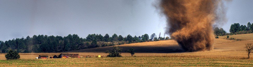
Vi um vídeo agora. Parece uma wall cloud na foto. O campo de vento em solo era mais reduzido. Pela foto eu tomei um susto.
-
CARALHO!!!!! Tenho amigos em Iowa City!!!!
-
Merece um Tornado Emergency esse tornado
-
Vai passar muito perto de Laverne. Se não atingir em cheio.
-
O mais intenso que eu vi esse ano.
-
Durante a madrugava um tornado atingiu os subúrbios da Cidade de Jefferson, capital do Missouri
-
Deve passar ao norte de Golden City. Depois disso praticamente não haverá cidades por um longo tempo.
-
Essa célula em Salina vai passar por Joplin mais tarde.
-
Muitas áreas apresentando rotação em Oklahoma
-
...TORNADO EMERGENCY FOR AREAS NEAR ORONOGO... ...A TORNADO WARNING REMAINS IN EFFECT UNTIL 845 PM CDT FOR WESTERN JASPER COUNTY... AT 818 PM CDT, A CONFIRMED LARGE AND DESTRUCTIVE TORNADO WAS LOCATED OVER ORONOGO, OR NEAR JOPLIN, MOVING NORTHEAST AT 25 MPH. TORNADO EMERGENCY FOR AREAS NEAR ORONOGO. THIS IS A PARTICULARLY DANGEROUS SITUATION. TAKE COVER NOW! HAZARD...DEADLY TORNADO. SOURCE...RADAR CONFIRMED TORNADO.
-
Mais um PDS Warning. Por pouco não há uma emergência ...A TORNADO WARNING REMAINS IN EFFECT UNTIL 845 PM CDT FOR WESTERN JASPER COUNTY... AT 809 PM CDT, A CONFIRMED LARGE AND EXTREMELY DANGEROUS TORNADO WAS LOCATED OVER CARL JUNCTION, OR NEAR JOPLIN, MOVING NORTHEAST AT 30 MPH. THIS IS A PARTICULARLY DANGEROUS SITUATION. TAKE COVER NOW! HAZARD...DAMAGING TORNADO. SOURCE...EMERGENCY MANAGEMENT CONFIRMED TORNADO.
-
Alerta estendido para o Missouri
-
Galena KS, Joplin MO e Webb City MO em perigo
-
PDS Tornado Warning pra baxter Springs ...A TORNADO WARNING REMAINS IN EFFECT UNTIL 800 PM CDT FOR SOUTHEASTERN CHEROKEE COUNTY... AT 736 PM CDT, A CONFIRMED LARGE AND EXTREMELY DANGEROUS TORNADO WAS LOCATED OVER TREECE, OR NEAR BAXTER SPRINGS, MOVING NORTHEAST AT 35 MPH. THIS IS A PARTICULARLY DANGEROUS SITUATION. TAKE COVER NOW!
-
Área do risco moderado entrando em ação SUMMARY...Risk for a strong tornado or two will continue, mainly near the Interstate 44 corridor of northeast Oklahoma through 8-10 PM. A transition to primarily a severe hail/wind risk is expected to gradually occur across the Missouri Ozarks and lower Missouri Valley by late evening. DISCUSSION...Vigorous thunderstorm development now progressing northeast of the Tulsa area remains generally discrete/supercellular. In the presence of lingering large boundary layer CAPE, strong deep layer vertical shear and enlarging low-level hodographs, there still appears potential for a strong tornado to form near the Interstate 44 corridor of northeast Oklahoma through 01-03Z. Otherwise, thunderstorm activity, including a few embedded supercells, has become increasingly numerous along a line northeast and east of Bartlesville OK through areas north/east of Sedalia MO. This is focused along a cold frontal zone, which is forecast to slowly advance eastward across the lower Missouri Valley and Missouri Ozarks vicinity through late evening. A gradual consolidation of storms is expected to take place in response to lift associated with warm advection, with perhaps a tendency for convection to become undercut by the front. As this occurs, the primary severe hazard probably will transition to severe hail with potential for strong convective gusts to increase.
-
Célula "jovem" apresentando rotação forte no Kansas
-
Virou bagunça
-
PDS Tornado Warning * AT 538 PM CDT, A CONFIRMED LARGE AND EXTREMELY DANGEROUS TORNADO WAS LOCATED 6 MILES SOUTHWEST OF OKMULGEE STATE PARK, MOVING NORTHEAST AT 30 MPH. THIS IS A PARTICULARLY DANGEROUS SITUATION. TAKE COVER NOW! HAZARD...DAMAGING TORNADO.
-
TDS nesta célula e vai passar muito próximo de Okmulgee
-
Segue se organizando e ganhando força
-
Tornado confirmado indo pra Okmulgee
-
Quanto menos tempestades, melhor.


