
Tavares
-
Posts
2869 -
Joined
-
Last visited
-
Days Won
4
Content Type
Profiles
Forums
Gallery
Calendar
Everything posted by Tavares
-
Hj foi um dos dias mais destruidores da erupção do Kilaues May 28, 2018 Lava Rips Lower Leilani
-
Harmony Korine, em 1997 roteirizou e dirigiu um filme sobre a corrosão moral da população de Xenia, OH, nos anos que se seguiram à passagem de um tornado em 1974. É um filme de ficção, bem pesado e violento (pra quem tem estômago). Eu particularmente me amarro. O tornado é citado muito brevemente nos créditos iniciais. O filme em si, tem um enredo mais social e psicológico.
-
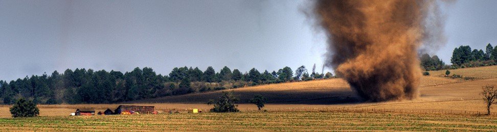
Radar mostra Assinatura de tornado numa célula na divisa entre Alabama e Tennessee
-
Essas células são a grande preocupação no SPC. Elas devem entrar em uma região ainda mais favorável pra se desenvolverem. Devem ser supercélulas de longa duração. The severe weather threat for Tornado Watch 13 continues. SUMMARY...Greatest tornado threat will be focused along warm front in northern AL through about 00z. Significant tornadoes will be possible. DISCUSSION...Supercells are intensifying along a surface trough across northeast MS, and these storms will spread across northern AL through the late afternoon/evening. The southwest-northeast orientation of the initiating surface trough has supported some storm interactions. However, even with a supercell cluster mode, the ongoing storms will move into a more favorable environment for tornadoes with time in AL. Low-level shear will be strongest near and north of the warm front, which also denotes the northeast edge of the most unstable portions of the warm sector (MLCAPE at or above 2000 J/kg). This corridor along the warm front will provide the most favorable environment for significant tornadoes for the next few hours as the supercells mature and begin to move east-southeastward along the boundary. ..Thompson.. 03/19/2018
-
Mortos no terremoto de Papua Nova Guiné podem passar dos 100 Poucas informações sobre casualidades após o tremor em PNG. Os últimos balanços do governo informaram 67 mortos, 500 feridas e 17.000 desabrigadas no terremoto, excluindo-se no número de fatalidades 11 pessoas que morreram soterradas em um deslizamento de terra após uma réplica de M6.0 no dia 4 de março de 2018. Há pessoas desaparecidas e o acesso aos locais afetados são prejudicados devido a estradas bloqueadas por deslizamentos. Os sobreviventes da região começam a sofrer por falta de suplementos básicos. Desde o terremoto principal, 5 réplicas tiveram magnitudes maiores que M6, o mesmo número de terremotos de magnitude igual ou superior na região desde o início dos registroso, de acordo com o banco de dados do USGS. Hoje (06 de Março) uma forte réplica de M6.7 atingiu a região.
-
FORTE TERREMOTO EM PAPUA NOVA GUINÉ Magnitude preliminar de 7.6. Segundo o EMSC o sismo ocorreu numa falha com histórico de tremores rasos, porém esse foi o maior terremoto registrado na região desde 1960
-
Terremoto no México Hoje um terremoto de magnitude 7.2 atingiu a região de divisa entre os estados de Oaxaca e Guerrero há uma profundidade de 24km. Alguns danos foram reportados na cidade de Pinotepa Nacional em Oaxaca mas sem registro de vítimas até o momento
-
Bóias oscilando bastante na região do epicentro
-
Um forte terremoto foi registrado na madrugada de hoje (23/01/18) no Golfo do Alasca. A magnitude revisada foi de 8.2 e profundidade de 19km. Um alerta de tsunami foi emitido mas pelo local do epicentro, não parece ter sido um movimento de subducção. **** NOTICE **** NOTICE **** NOTICE **** NOTICE **** NOTICE ***** PRELIMINARY EARTHQUAKE PARAMETERS --------------------------------- * MAGNITUDE 8.0 * ORIGIN TIME 0932 UTC JAN 23 2018 * COORDINATES 56.0 NORTH 149.2 WEST * DEPTH 19 KM / 12 MILES * LOCATION GULF OF ALASKA EVALUATION ---------- * AN EARTHQUAKE WITH A PRELIMINARY MAGNITUDE OF 8.0 OCCURRED IN THE GULF OF ALASKA AT 0932 UTC ON TUESDAY JANUARY 23 2018. * BASED ON THE PRELIMINARY EARTHQUAKE PARAMETERS... WIDESPREAD HAZARDOUS TSUNAMI WAVES ARE POSSIBLE. TSUNAMI THREAT FORECAST ----------------------- * HAZARDOUS TSUNAMI WAVES FROM THIS EARTHQUAKE ARE POSSIBLE WITHIN THE NEXT THREE HOURS ALONG SOME COASTS OF NO AREAS COVERED BY THIS MESSAGE APPEAR TO BE IMMEDIATELY THREATENED. HOWEVER... THE SITUATION IS STILL UNDER INVESTIGATION. THIS THREAT EVALUATION WILL BE UPDATED AS SOON AS FURTHER INFORMATION BECOMES AVAILABLE. RECOMMENDED ACTIONS ------------------- * GOVERNMENT AGENCIES RESPONSIBLE FOR THREATENED COASTAL AREAS SHOULD TAKE ACTION TO INFORM AND INSTRUCT ANY COASTAL POPULATIONS AT RISK IN ACCORDANCE WITH THEIR OWN EVALUATION... PROCEDURES AND THE LEVEL OF THREAT. * PERSONS LOCATED IN THREATENED COASTAL AREAS SHOULD STAY ALERT FOR INFORMATION AND FOLLOW INSTRUCTIONS FROM NATIONAL AND LOCAL AUTHORITIES. POTENTIAL IMPACTS ----------------- * A TSUNAMI IS A SERIES OF WAVES. THE TIME BETWEEN WAVE CRESTS CAN VARY FROM 5 MINUTES TO AN HOUR. THE HAZARD MAY PERSIST FOR MANY HOURS OR LONGER AFTER THE INITIAL WAVE. * IMPACTS CAN VARY SIGNIFICANTLY FROM ONE SECTION OF COAST TO THE NEXT DUE TO LOCAL BATHYMETRY AND THE SHAPE AND ELEVATION OF THE SHORELINE. * IMPACTS CAN ALSO VARY DEPENDING UPON THE STATE OF THE TIDE AT THE TIME OF THE MAXIMUM TSUNAMI WAVES. * PERSONS CAUGHT IN THE WATER OF A TSUNAMI MAY DROWN... BE CRUSHED BY DEBRIS IN THE WATER... OR BE SWEPT OUT TO SEA.
-
Feliz 2018! Esse foi o terremoto de maior magnitude no Mar do Caribe desde o início dos registros. Investigações preliminares do USGS calculam um movimento horizontal de até 24m numa área cerca de 140 km de extensão entre a placa do caribe e a placa norte-americana.
-
A pequena ilha de Kadovar (pequena mas porém é apenas o cume d'um vulcão) apresentou atividade no último dia 5 de janeiro. É a primeira atividade nos registros do vulcão que se tem conhecimento e há um temor de que se a erupção se tornar explosiva ou lateral (nota-se uma fenda no flanco do vulcão), possa ocorrer tsunamis na costa norte de Papua Nova Guiné. Um deslizamento submarino após um terremoto provocou tsunamis que causaram 10.000 mortes na região em 1998. Ainda hoje, 7 de janeiro, notava-se bastante gases e cinzas sendo expelidas pelas imagens de satélite. Estima-se que 500 pessoas vivam na ilha e todas foram evacuadas, segundo o jornal australiano " The Australian" f6b0474d264cc02ec803afe198339104.jfif
-
Atividade do Agung aumentando nessa segunda-feira
-
No último balanço divulgado ontem, eram pelo menos 530 as vítimas fatais do terremoto entre Irã e Iraque. A versão final do shakemap do USGS:
-
Com mais de 300 mortos contabilizados até o momento esse sismo no Irã e Iraque já é o mais letal do ano de 2017.
-
De acordo com o banco de dados do EMSC, desde 1960 não há registro de nenhum terremoto nem perto dessa magnitude na região Segundo o USGS o mais forte terremoto desde 1850 nesta área foi um de magnitude 6.1 em 1967 cerca de 150 km ao sul do epicentro de hoje, que foi no Irã. O único de magnitude 6+ nos registros. 136 mortes já confirmadas, ainda é madrugada na região e o numero deve aumentar com as buscas durante o dia.
-
 Seriam dois ciclones interagindo no AS. Ambos sendo simétricos em algum momento. O Que eu entendi, uma baixa se aprofundaria à partir do ramo frontal associado a outra baixa formada no Prata e direcionaria esta no sentido NE. Bem estranho. O CMC também indica essa possibilidade. Primeira Segunda CMC
 -
Lembrando que o GFS tá com esse bug 8 ou 80, Ou o ciclone é poderosíssimo ou não existe. Desde maio não há um ciclone nomeado no índico. O próximo nome da lista é Ockhi.
-
GFS vem insistindo a algumas rodadas n'um catastrófico ciclone na extremamente populosa região entre Índia e Bangladesh (300 milhões de pessoas vivendo numa região de altitude máxima abaixo de 10 metros). Modelo Canadense também aponta pra formação do ciclone no golfo da Tailândia mas com rota diferente e intensidade menor. Europeu ignora o sistema.
-
O JTWC prevê Lam atingindo Tóquio com ventos de 139 km/h e rajadas de 166,5 km/h porém, já li em algum lugar que esses ciclones anulares tendem a se manterem bem estruturados mesmo em águas menos aquecidas. Só não sei o porquê.
-
Risco de grau 3 (enhanced) pra Oklahoma amanhã 21/10. ...SUMMARY... Widespread thunderstorm development is expected late Saturday afternoon into Saturday night, from portions of the upper Mississippi Valley into the southern Plains. Some of this activity, particularly across the Plains, will be accompanied by a risk for potentially damaging wind gusts, some hail and perhaps a couple of tornadoes. ...Synopsis... Models indicate that large-scale mid/upper troughing, currently advancing inland of the Pacific Coast, will remain progressive through this period, likely reaching Manitoba, northwest Ontario, the upper Mississippi Valley and southern U.S. Plains by 12Z Sunday. Within this regime, the corridor of strongest mid-level height falls are forecast to spread east/northeast of the Canadian Prairies and northern U.S. Plains Saturday/Saturday night, associated with a couple of significant embedded short wave impulses. But another digging impulse may contribute to mid-level height falls across the southern Plains Red River Valley region Saturday night, while beginning to split away from the base of larger-scale troughing to the north. In lower levels, a deep associated surface cyclone is forecast to migrate from southern Manitoba into Hudson Bay, while a modest trailing cold front advances eastward/southeastward through much of the U.S. Plains and mid/upper Mississippi Valley region by the end of the Period. ...Plains/Mississippi Valley... Models generally indicate that the mid-level cold core and strongest mid-level forcing for ascent may tend to lag to the west of the cold front through the period. And severe weather potential, in general, may hinge on how fast the eastward and southeastward advancing cold front tends to undercut the pre-frontal initiating convective development, which remains unclear at this time. However, it appears that there will be at least a window of opportunity for substantive pre-frontal thunderstorm activity, accompanied by a risk for severe weather. At least a narrow plume of seasonably moist air (characterized by mid/upper 60s surface dew points) appears likely to precede the front in a corridor from the southern Plains into the upper Mississippi Valley. Models suggest that low-level moistening will occur beneath a plume of modestly steep lapse rates associated with elevated mixed layer air, which may contribute to CAPE up to 1000+ J/kg, and 2000 J/kg across north central Texas into Oklahoma. Although deep layer wind fields are not expected to be exceptionally strong, 30-50 kts in lower/mid-levels (somewhat stronger across parts of the lower Missouri Valley into upper Mississippi Valley), should be more than sufficient to support organized severe weather potential, given the instability. Guidance appears suggestive that vigorous storm development may initiate first across parts of the east central Plains and middle Missouri Valley late Saturday afternoon, before intensifying while increasing and spreading northeastward toward the upper Mississippi Valley through Saturday evening. This could include isolated discrete supercells early, before evolving into a broken squall line, with damaging wind gusts becoming the primary severe threat. Farther south, stronger instability, coupled with increasing forcing for ascent (enhanced by increasingly divergent high-level flow) may support storm initiation across parts of western/northern Oklahoma and adjacent portions of the Plains by early Saturday evening. This may include discrete supercells initially, in a corridor ahead of the cold front, and near its intersection with the dry line. However, fairly rapid and considerable upscale convective growth appears probable, with potentially damaging wind gusts becoming the primary concern by mid to late evening, before tending to become undercut by the southward advancing cold front. ..Kerr.. 10/20/2017
-
Assunção sendo castigada a horas por tempestades
-
Eu nunca vi os radares do Simepar apresentarem reflectividade "forte" de acordo com a própria escala. Nos do IPMet eu já desisti. Só uma tempestade muito intensa pra aparecer no radar. Continua estranho.
-
Uma célula que atravessou a divisa entre MS e SP aparenta apresentar rotação e apresentou um breve gancho na parte posterior da tempestade e e em sentido horário. Certamente uma supercélula com potencial tornádico. Por estar bem na borda tanto dos radares do IPMet quanto dos da aeronáutica, aparece bem distorcido e com localização incerta. Mas se dirige pra região de Três Lagoas - MS / Andradina - SP. EDIT
-
Sempre que eu comparava as imagens de radar com as do canal visível nos episódios de tempo severo nos EUA, esses contornos coincidiam com o limite das nuvens-bigorna, que se expandem bastante da área de precipitação. É o caso aqui no RS também?
-
Essa noite em São paulo ouvi o primeiro trovão desde o início do inverno. A Glória!
