Miguel Russe
-
Posts
777 -
Joined
-
Last visited
Content Type
Profiles
Forums
Gallery
Calendar
Posts posted by Miguel Russe
-
-
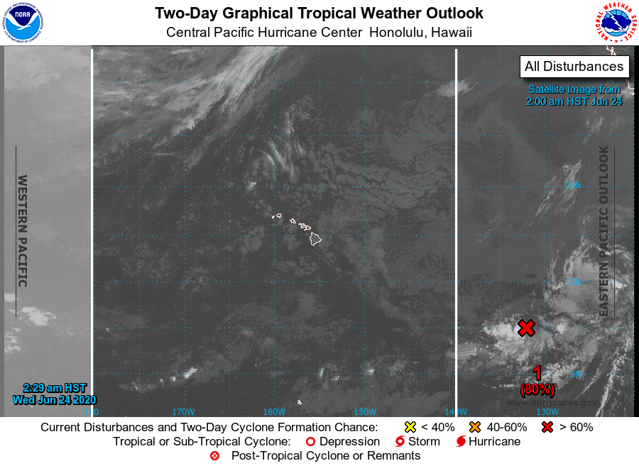
E no Pacífico Leste e Central, temos 3 invest's, sendo uma quarta invest esperada pra se formar.
No Pacífico Leste, temos 92E, 93E, 94E e a futura 95E.
No Pacífico Central, temos 93E.
93E e 94E devem virar Boris e Cristina ou Hone e Boris.

ropical Weather Outlook
NWS National Hurricane Center Miami FL
500 AM PDT Wed Jun 24 2020

For the eastern North Pacific...east of 140 degrees west longitude:

1. Showers and thunderstorms have become more concentrated overnight
near the center of a small area of low pressure located about 1700
miles southwest of the southern tip of the Baja California
peninsula.  If this development trend continues, a tropical
depression could develop later today or tonight while it moves
slowly toward the west or west-northwest.
* Formation chance through 48 hours...high...80 percent.
* Formation chance through 5 days...high...80 percent.

2. An elongated area of low pressure located several hundred miles
southwest of the southern tip of the Baja California peninsula
continues to produce a wide area of disorganized showers and a few
thunderstorms.  Some development of this system is possible during
the next day or so while the system moves westward at about 15 mph
before it moves over cooler waters.
* Formation chance through 48 hours...low...30 percent.
* Formation chance through 5 days...low...30 percent.

3. Disorganized showers and thunderstorms located a few hundred miles
south of the southwestern coast of Mexico are associated with a
tropical wave.  Environmental conditions are forecast to be
conducive for development, and the system is likely to become a
tropical depression within the next few days while it moves
west-northwestward parallel to the coast of Mexico.
* Formation chance through 48 hours...medium...60 percent.
* Formation chance through 5 days...high...80 percent.

4. Another area of low pressure is forecast to form south of the Gulf
of Tehuantepec by late this week. Gradual development of this system
will be possible over the weekend as it moves west-northwestward
parallel to the coast of Mexico.
* Formation chance through 48 hours...low...near 0 percent.
* Formation chance through 5 days...low...30 percent.
-
 1
1
-
-
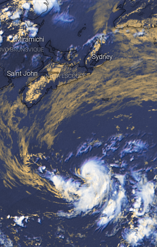
No atlântico, acabou a guaraná. Dolly virou DT ontem de madrugada e deve virar um baixo remanecente hoje a tarde ou a noite.
----------------------------------------------------------------------------------------------------------------------------------------------
BULLETIN
Tropical Depression Dolly Advisory Number   8
NWS National Hurricane Center Miami FL       AL042020
500 AM AST Wed Jun 24 2020

...DOLLY WEAKENS TO A TROPICAL DEPRESSION...
...EXPECTED TO BECOME A REMNANT LOW LATER TODAY...


SUMMARY OF 500 AM AST...0900 UTC...INFORMATION
----------------------------------------------
LOCATION...41.7N 59.0W
ABOUT 450 MI...725 KM SW OF CAPE RACE NEWFOUNDLAND
MAXIMUM SUSTAINED WINDS...35 MPH...55 KM/H
PRESENT MOVEMENT...NE OR 45 DEGREES AT 12 MPH...19 KM/H
MINIMUM CENTRAL PRESSURE...1005 MB...29.68 INCHES
-
2
-
 1
1
-
-
7 minutos atrás, mario junior disse:
Dolly
Dolly ja tem oho.
Acho que chega talvez num 65 mph e 990 mbar.
Mas no fundo, so quero que Dolly fique com 74mph e 985 mbar
-
2
-
-
NHC monitora 4 areas no momento.
Proximos nomes são: Boris, Cristina, Douglas e Elida.
Tropical Weather Outlook
NWS National Hurricane Center Miami FL
1100 AM PDT Tue Jun 23 2020

For the eastern North Pacific...east of 140 degrees west longitude:

1. A nearly stationary area of low pressure is located about 1600
miles southwest of the southern tip of the Baja California
peninsula. Although the associated shower and thunderstorm activity
has decreased since yesterday, environmental conditions
are forecast to be conducive for gradual development, and this
system is likely to become a tropical depression during the
next few days while it moves slowly westward.
* Formation chance through 48 hours...medium...50 percent.
* Formation chance through 5 days...high...70 percent.

2. An elongated area of low pressure located several hundred miles
southwest of the southern tip of the Baja California peninsula
is producing a large area of disorganized cloudiness and
thunderstorms.  Environmental conditions are forecast to be
conducive for some gradual development over the next couple of
days, but the disturbance is forecast to move over cooler
waters after that time which should inhibit further development.
* Formation chance through 48 hours...medium...50 percent.
* Formation chance through 5 days...medium...50 percent.

3. Disorganized showers and thunderstorms located a few hundred miles
south-southwest of the Gulf of Tehuantepec are associated with a
tropical wave.  Environmental conditions appear favorable for
development, and the system is likely to become a tropical
depression in a few days while it moves west-northwestward
parallel to the coast of Mexico.
* Formation chance through 48 hours...medium...40 percent.
* Formation chance through 5 days...high...80 percent.

4. Another area of disturbed weather is forecast to form south of the
Gulf of Tehuantepec by late this week. Environmental conditions are
expected to be conducive for gradual development of this system
over the weekend as it moves west-northwestward parallel to the
coast of Mexico.
* Formation chance through 48 hours...low...near 0 percent.
* Formation chance through 5 days...low...30 percent.
-
4
-
-
1 hora atrás, Tavares disse:
Forte terremoto foi registrado no México
Magnitude preliminar de M7.7 segundo o USGS. EMSC fora do ar.
-
13 minutos atrás, Tavares disse:
Pronto! Tá aí a sua Dolly.
=======================================================================
000
WTNT64 KNHC 231613
TCUAT4

Tropical Storm Dolly Tropical Cyclone Update
NWS National Hurricane Center Miami FL       AL042020
1215 PM AST Tue Jun 23 2020

...DOLLY FORMS OVER THE NORTH ATLANTIC...

Recent satellite-derived wind data indicate that Subtropical
Depression Four has strengthened, and maximum sustained winds are
now 45 mph (75 km/h) with higher gusts.  In addition, the wind
field has contracted, and the system has made a transition to a
tropical storm.

A Special Advisory on Tropical Storm Dolly will be issued by 100 PM
AST (1700 UTC) to update the intensity forecast.


SUMMARY OF 1215 PM AST...1615 UTC...INFORMATION
----------------------------------------------
LOCATION...39.4N 61.9W
ABOUT 370 MI...595 KM SSE OF HALIFAX NOVA SCOTIA
ABOUT 660 MI...1065 KM SW OF CAPE RACE NEWFOUNDLAND
MAXIMUM SUSTAINED WINDS...45 MPH...75 KM/H
PRESENT MOVEMENT...ENE OR 65 DEGREES AT 13 MPH...20 KM/H
MINIMUM CENTRAL PRESSURE...1002 MB...29.59 INCHES

$$
Forecaster Berg/Brown
Valeu✌
Estão servidos?
-
1
-
-
2 minutos atrás, Victor Naia disse:
Londrina. Deverei estar na cidade na próxima terça-feira até sexta. Caso confirme o frio, vou planejar para ir na quinta, e voltar na segunda.
Se londrina fizer 1°C, minha casa congela a 500 km de distância!
-
3
-
 1
1
-
-
1 hora atrás, victorgomes334 disse:
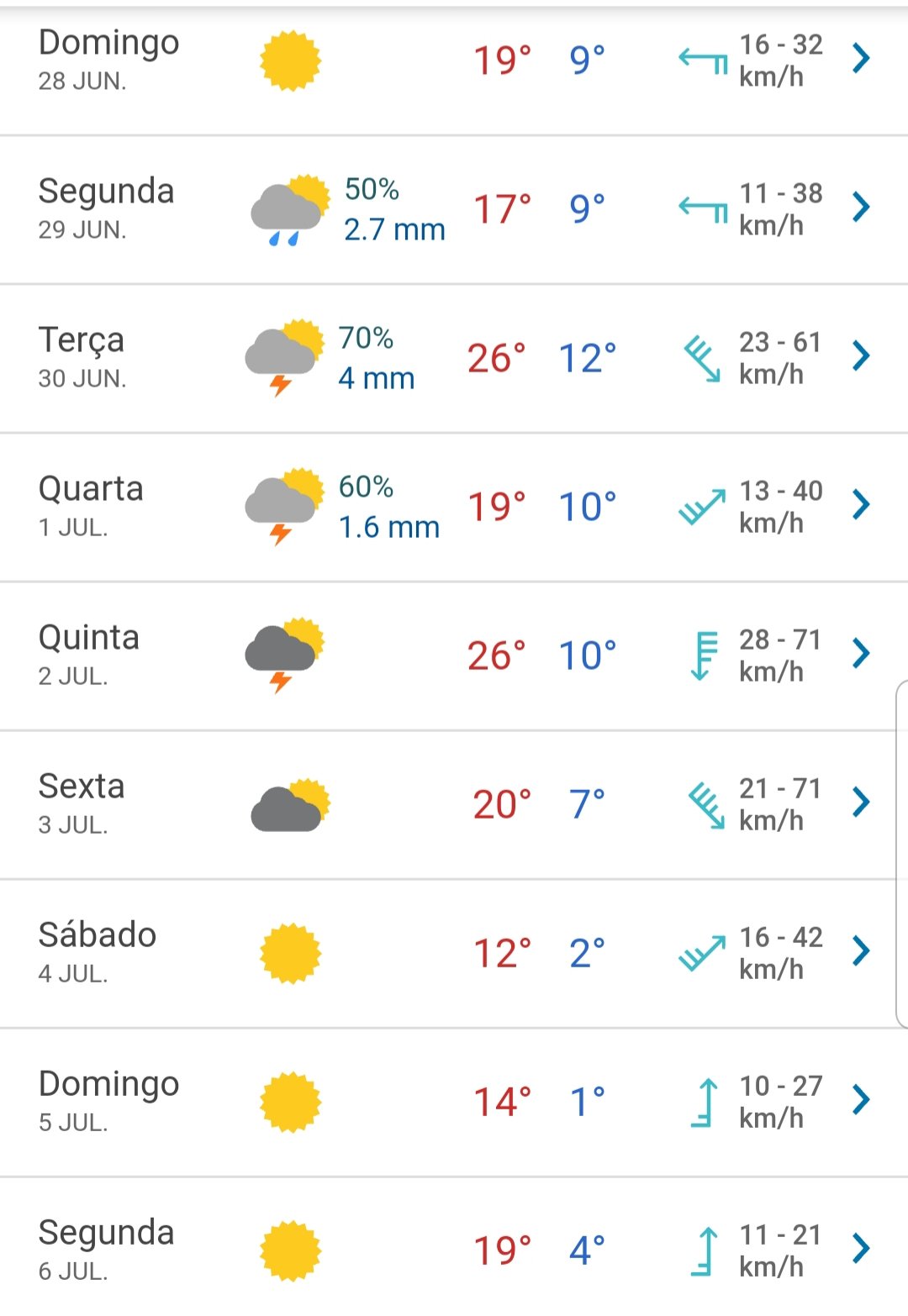
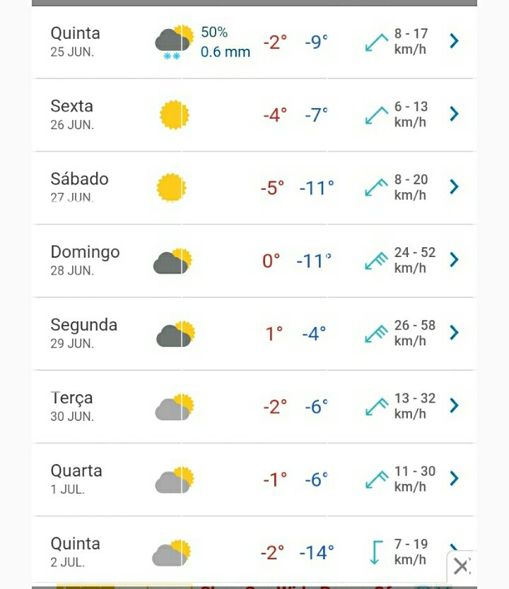
Rio Turbio, Santa Cruz, Argentina
Próximos 8 dias serão frios lá :
E mto azar eu estar morar onde nunca caiu um unico floco de neve na historia....
Mas enfim, acho demais maxima de -2°C e minima -14°C ja no começo de tudo, se de um jeito ou de outro e muuito raro eu ver isso em menos de 20 days depois do começo do inverno na América do Sul. Alguem pode me dizer pq ja tem -14°C tampouco tempo? se for aquelas cidades laaaa onde fica bem no sul da America, ja entendo e concordo com a previsão.
-
4
-
-
Alguem sabe se o BAZ antigo esta ativo?
Estava dando uma fuçada la no fundo do topico e vi um link q leva ate la, mas não esta mais disponivel.
Se alguem souber como ir la, por favor dizer p mim, pois estou curioso p saber o que tem la.
Att
-
1
-
-
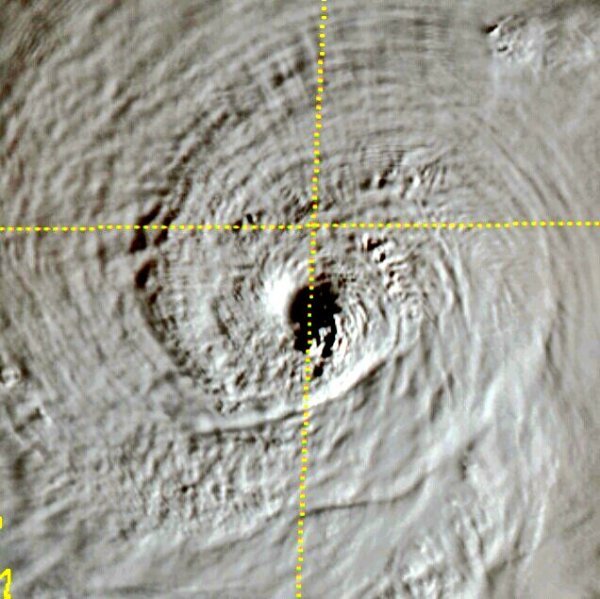
27 minutos atrás, Felipe F disse:
ST4
Ja tem o olho subtropical. Agora so falta 04L ser nomeado Dolly guaraná Dolly
-
2
-
-
Subtropical Depression 04L se formou as 17:30 do horario de Brasilia.
-
1
-
1
-
-
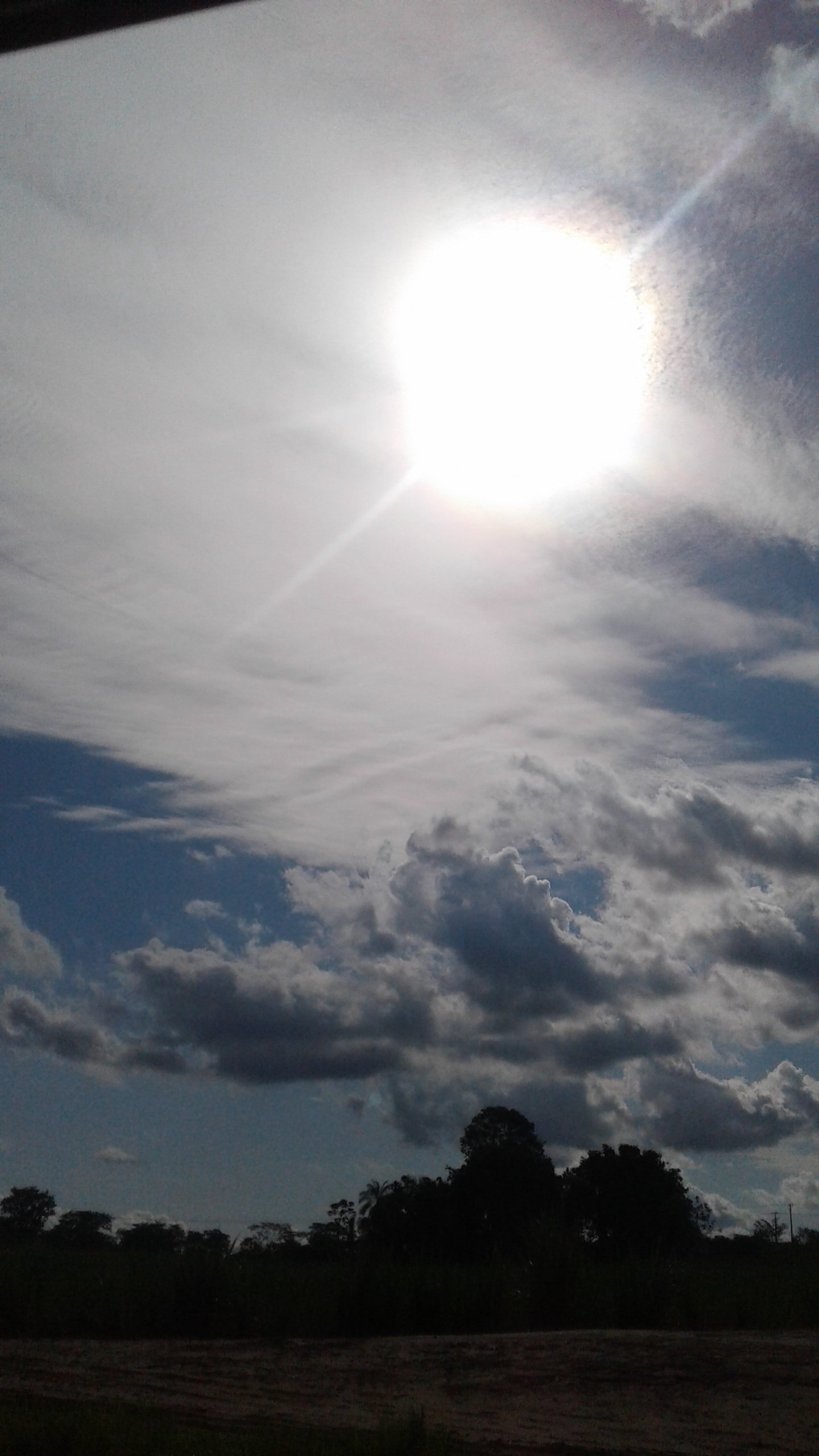
Boa tarde a todos. Vamos hoje anoitecer com um belo friozinho, com minha cidade reportando 24,7°C.
o AccuWether diz que entre as 1:00 e as 5:00 vai cair uma geadinha beeem fraca.
qual vai ser a minima de SP entre Terça e quarta dessa semana?
-
2
-
 3
3
-
-
E enquanto isso no pacifico leste, O NHC deixa um belo movimento de Invest's
Tres com media chance e 1 com uma baixa chance.
Tropical Weather Outlook
NWS National Hurricane Center Miami FL
1100 AM PDT Mon Jun 22 2020

For the eastern North Pacific...east of 140 degrees west longitude:

1. An area of low pressure located more than 1000 miles southwest
of the southern tip of the Baja California peninsula continues to
produce disorganized showers and thunderstorms. Environmental
conditions are expected to be conducive for gradual development,
and this system could become a tropical depression during the next
few days while it moves generally westward.
* Formation chance through 48 hours...medium...40 percent.
* Formation chance through 5 days...medium...60 percent.

2. Showers and thunderstorms associated with a broad area of low
pressure located several hundred miles south of the southern tip
of the Baja California peninsula, have changed little in
organization since yesterday.  Environmental conditions are
forecast to be conducive for gradual additional development, and a
tropical depression could form during the next two to three days
while the disturbance moves westward.  After that time, cooler
waters are likely to inhibit further development.
* Formation chance through 48 hours...medium...50 percent.
* Formation chance through 5 days...medium...60 percent.

3. An area of disturbed weather is forecast to form south of the
coast of Mexico in a couple of days.  Development is expected to
occur after that time, and the system could become a tropical
depression by late this week as the disturbance moves
west-northwestward parallel to the coast of Mexico.
* Formation chance through 48 hours...low...near 0 percent.
* Formation chance through 5 days...medium...60 percent.

4. Another area of disturbed weather is forecast to form south of the
Gulf of Tehuantepec by late this week. Environmental conditions are
expected to be conducive for gradual development of this system
over the weekend as it moves west-northwestward parallel to the
coast of Mexico.
* Formation chance through 48 hours...low...near 0 percent.
* Formation chance through 5 days...low...20 percent.
-
2
-
-
Bem, mudando de assunto, 94L deve virar SD 04L ou SS Dolly amanhã de manha ou hj a noite.
Special Tropical Weather Outlook
NWS National Hurricane Center Miami FL
405 PM EDT Mon Jun 22 2020

For the North Atlantic...Caribbean Sea and the Gulf of Mexico:

Special Tropical Weather Outlook issued to discuss the development
of a Subtropical Depression over the northwestern Atlantic.

1. Shower and thunderstorm activity associated with a well-defined low
pressure system located about 350 miles southeast of Cape Cod,
Massachusetts, has continued to get better organized today, and a
subtropical depression appears to be forming.  If these trends
continue, advisories will be initiated on this system at 500 PM AST
this afternoon. This system is expected to move eastward and
northeastward away from the United States during the next couple of
days.
* Formation chance through 48 hours...high...80 percent.
* Formation chance through 5 days...high...80 percent.
-
3
-
-
1 hora atrás, Felipe F disse:
Um ciclone para ser aposentando precisa matar centenas ou milhares de pessoas ou causar danos bilionários.
Não existe nenhuma chance de ambos serem aposentados.
Vixi, e msm. Esqueci disso!
E eu que achei q Dorian n seria retirado kkk
Eu lembrei q a comissão anual da Org. Mundial da meteorologia foi adiada pela Covid.
-
Invest 92E esta se organizando:
Tropical Weather Outlook
NWS National Hurricane Center Miami FL
500 AM PDT Sun Jun 21 2020

For the eastern North Pacific...east of 140 degrees west longitude:

1. A broad area of low pressure located more than 1000 miles southwest
of the southern tip of the Baja California peninsula is producing
disorganized showers and thunderstorms. Environmental conditions
could support some slow development of this system during the next
few days while the disturbance moves generally westward.
* Formation chance through 48 hours...low...10 percent.
* Formation chance through 5 days...low...30 percent.

2. A low pressure system is producing a broad area of showers and
thunderstorms several hundred miles south of the southwestern coast
of Mexico. Some gradual development of this system is possible
through the middle of this week while it moves westward, away from
the coast of Mexico.
* Formation chance through 48 hours...low...20 percent.
* Formation chance through 5 days...medium...40 percent.

3. Another area of disturbed weather is forecast to form south of the
coast of Mexico by the middle of this week. Additional development
could then occur as the system moves west-northwestward parallel to
the coast of Mexico.
* Formation chance through 48 hours...low...near 0 percent.
* Formation chance through 5 days...low...30 percent.
-
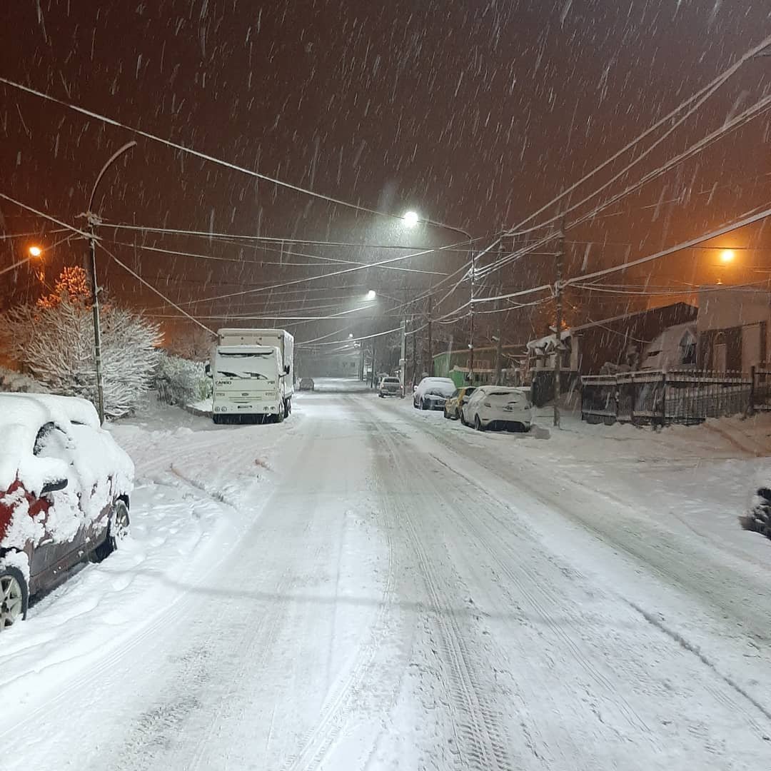
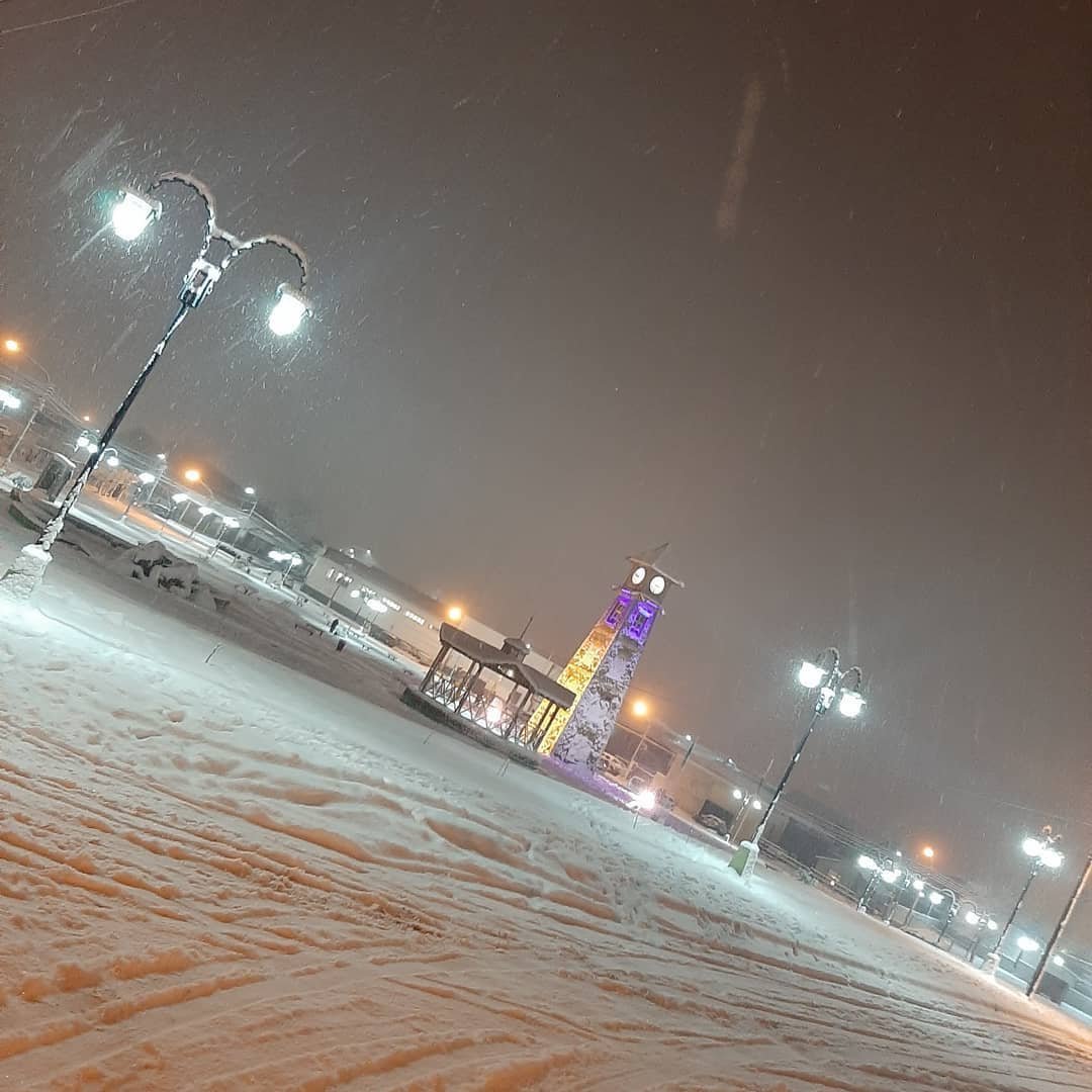
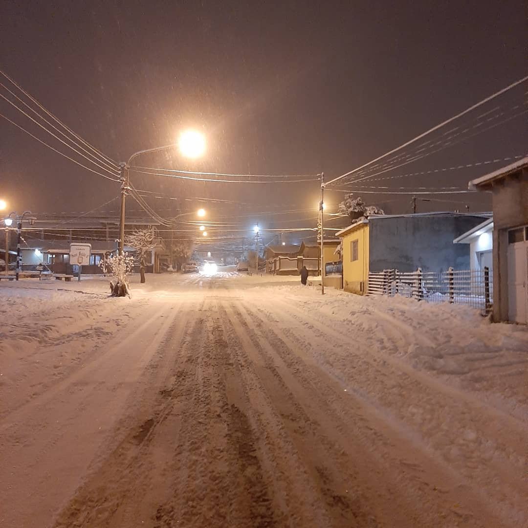
4 minutos atrás, Davi Silva disse:
Olha o tamanho disso!!!
Imposiveellll
-
2
-
-
Reportando 23,5°C na estação aqui perto de casa
AccuWether prevendo 16°C de minima para a madrugada de hj,
dormirei com a janela aberta p entrar aquele friozinho de ar condicionado q gosto😊🌈☁🌖
tenham todos uma boa noite.
-
5
-
-
Pacifico movimentado
1°- Ex- 92E
2°- 93E
3°- Futura area de investigação
Tropical Weather Outlook
NWS National Hurricane Center Miami FL
500 PM PDT Sat Jun 20 2020

For the eastern North Pacific...east of 140 degrees west longitude:

1. A broad area of low pressure located more than 1000 miles southwest
of the southern tip of the Baja California peninsula is producing
disorganized showers and thunderstorms.  Environmental conditions
could support some slow development of this system through early
next week while the disturbance moves generally westward.
* Formation chance through 48 hours...low...near 0 percent.
* Formation chance through 5 days...low...30 percent.

2. An area of disturbed weather has developed a few hundred miles south
of the southwestern coast of Mexico. Some slow development of this
system is possible through early next week as it moves westward,
away from the coast of Mexico.
* Formation chance through 48 hours...low...10 percent.
* Formation chance through 5 days...low...30 percent.

3. Another area of disturbed weather is forecast to form south of the
coast of Mexico by the middle of next week.  Additional development
could then occur as the system moves west-northwestward parallel to
the coast of Mexico.
* Formation chance through 48 hours...low...near 0 percent.
* Formation chance through 5 days...low...20 percent.
-
1
-
-
25 minutos atrás, Felipe F disse:
Muito calor em Florianópolis no dia do solstício de "inferno".
Temperaturas máximas até o momento:
Lagoa da Conceição: 27,9ºC
Carijos: 28,9ºC
Sertão do Ribeirão: 29,2ºC
Santo Antônio Lisboa: 30,5ºC
INMET: 30,5ºC
Ressacada: 30,5ºC
AERO: 31ºC (maior valor desde 1997)
Itacorubi: 31,1ºC (recorde 2001-2020)
Açores: 31,4ºC
UFSC (CCA): 32,1ºC
Nossa. Deve ter uma massa de calor em Floripa, né?
Aqui perto de casa uma estação de 2 km de distância (estação da praça) reportou 34,7°C
Esta dificil esse Junho
-
1
-
1
-
 3
3
-
-
YAY! -1,5???
Meu Deus! Nem começou o inverno e já temos temperatura negativa?!
Ei, Climatempo! Olha só isso antes de falar que nosso inverno vai ser quentão!
Todos bem agasalhados! Se for o q estou pensando, haja chocolate quente!
19 minutos atrás, Gabriel Cardoso disse:Bom dia,
Uma das poucas geadas esse mês no charco, hoje -1,5°C:
-
2
-
2
-
2
-
-
Começamos bem o Inverno, com temperatura beem fresquinha no Sul e Sul do Sudeste
Temperatura das capitais do Sul e Sudeste ás 10:05 da manhã no horário de Brasilia.
======================================================================
SUL:
Porto Alegre:21°C
Florianópolis: 26°C
Curitiba: 18°C
SUDESTE:
São Paulo: 19°C
Belo Horizonte: 19°C
Rio de Janeiro: 23°C
CAPITAIS MAIS FRIAS:
1°- Curitiba: 18°C
2°-São Paulo: 19°C
3°-Belo Horizonte: 19°C. Fonte: Windyty
======================================================================
-
7
-
-
Olá Bazianos! Sou Miguel Russe e vim fazer minha apresentação.
Já estou aqui ha mais ou menos 4 meses. Mas eu ja observo essa comunidade ha 1 ano, quando eu tinha pesquisado temperaturas negativas de 2019 e vi essa pagina no meio dos resultados. Me interessei e fui ver o que era e descobri que era uma comunidade de meteorologia. Achei interessante, pois eu ja acompanhava a meteorologia ha um bom tempo. Aí fui acompanhando frequentemente o topico e em feveiro de 2020 (esse ano) eu criei minha conta aqui no BAZ. Eu nasci em Sud Mennucci, beem no interior do estado. Gosto de medicina, meteorologia e esporte.
Colaborarei o possível com o BAZ.
Grandes Abraços!
-
4
-
1
-
-
4 horas atrás, Tavares disse:
Se começarem a retirar nomes de tempestades como Cristobal em 30 anos o Atlântico vai ter furacões com nomes tipo Walklédissom e Francislayne
Heheh vai ter só nome brazuca
Acho que para Cristobal não tem necessidade de colocar outro nome diferente com a letra C. É simples: é só subtituir Cristobal para Cris, mas o nome ficará com o mesmo pronunciamento de Chris. Por mim, tanto faz se Cris terá a mesma pronúncia que Chris. Apenas ficará sem o H.
Para Amanda, digo o mesmo. Eu falo nesses 3 nomes no caso de Amanda ser retirado Mas: 2 serão um pouco ou muito diferentes. Vejam:
Alanda, Aaron e Alicia.
Simples!
-
2
-
.png.9bca515659cc1601dc6aec36d90656cd.png)
.png.370235ed89f81edc80f27381f31867ae.png)
.png.a86dc94b4ced6144f7a2cd546c4c08de.png)
.png.0129c392d4bdc20b4cd033bc5b73d457.png)


.png.1bfffda3fbadebff517f635eb0fd92e2.png)
.png.96afe6c4168b37ce628ea051a5da82ed.png)
.png.c7f9ad152c8c78fde0b439953e1d37a8.png)
.png.93095d8d6cf38bf79559bf0fc9086560.png)


Furacões no Atlântico Norte e Pacífico Leste e Central - 2020
in Monitoramento de Furacões, Tufões e Ciclones Tropicais
Posted
Eu sei
Eu disse isso para dizer que 93E podia cruzar a bacia do Pacífico Leste ao Central!
Como se fosse assim:
"No Pacífico Central, temos 93E que está prestes a entrar na bacia"
Mas falando em 93E, Vejam: