

Miguel Russe
-
Posts
777 -
Joined
-
Last visited
Content Type
Profiles
Forums
Gallery
Calendar
Everything posted by Miguel Russe
-
 05E agora é dor no pancreas pra mim. NHC não tem coragem de fazer um aviso especial para atualizar 05E p TS Estou morrendo de medo do NHC n atualizar 05E p Cristina. Minhas estimativas variam entre 50 e 60 mph, e pressão de 996 ou 993 mbar. E tirando isso, estou em casa torcendo para que meu teste de Covid fique negativo, pq tive dor de cabeça e febre😣 Mas, deus abençoe todos para q vcs passem o sufoco de ansiedade q estou
 -
TD 05E finalmente se formou. NHC e os outros demais modelos dizem que o futuro Cristina será um furacão. BULLETIN Tropical Depression Five-E Advisory Number 1 NWS National Hurricane Center Miami FL EP052020 400 PM CDT Mon Jul 06 2020 ...TROPICAL DEPRESSION FORMS WELL SOUTH OF MEXICO... ...EXPECTED TO STEADILY STRENGTHEN OVER THE NEXT FEW DAYS... SUMMARY OF 400 PM CDT...2100 UTC...INFORMATION ---------------------------------------------- LOCATION...10.5N 99.7W ABOUT 440 MI...710 KM S OF ACAPULCO MEXICO MAXIMUM SUSTAINED WINDS...35 MPH...55 KM/H PRESENT MOVEMENT...WNW OR 295 DEGREES AT 13 MPH...20 KM/H MINIMUM CENTRAL PRESSURE...1007 MB...29.74 INCHES WATCHES AND WARNINGS -------------------- There are no coastal watches or warnings in effect. DISCUSSION AND OUTLOOK ---------------------- At 400 PM CDT (2100 UTC), the center of Tropical Depression Five-E was located near latitude 10.5 North, longitude 99.7 West. The depression is moving toward the west-northwest near 13 mph (20 km/h) and this general motion is expected to continue during the next few days. Maximum sustained winds are near 35 mph (55 km/h) with higher gusts. Steady strengthening is predicted during the next 48 hours and the depression is forecast to become a tropical storm tonight, and it could become a hurricane on Wednesday. The estimated minimum central pressure is 1007 mb (29.74 inches). HAZARDS AFFECTING LAND ---------------------- None NEXT ADVISORY ------------- Next complete advisory at 1000 PM CDT. $$ Forecaster Brown
-
Vi que ngm tocou no assunto, mas vamos la Uma onda tropical que atualmente e monitorada pelo NHC trouxe algumas pancadas de chuvas para o Amapá, tendo algumas explosões de convecção de 1 á 3 km de largura, causando pequeninos alagamentos em poucas city's. Mas, acho q n foi nada, pois a onda ficou mais ao norte, o que representa 1% de grandes perigos para cá.
-
Se 98L virar Fay, vai ser a TS que mais cedo se formou com a letra F?
-
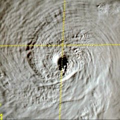
Uma das tormentas mais fofas q já vi :-0
-
TS. Dudu se forma no atlantico. Deve virar extratropical Amanhã cedo. Edouard é a tormenta com a letra E que mais cedo se formou em toda a história. Mas, como nosso querido amigo Pablo Martins disse, não tem tanta importância a tormenta ter recordes se e sem pouca vida e é fraca e se é no subtropico BULLETIN Tropical Storm Edouard Advisory Number 7 NWS National Hurricane Center Miami FL AL052020 1100 PM AST Sun Jul 05 2020 ...EDOUARD FORMS OVER THE FAR NORTH ATLANTIC... ...EXPECTED TO BECOME POST-TROPICAL ON MONDAY... SUMMARY OF 1100 PM AST...0300 UTC...INFORMATION ----------------------------------------------- LOCATION...37.2N 56.9W ABOUT 685 MI...1100 KM SSW OF CAPE RACE NEWFOUNDLAND MAXIMUM SUSTAINED WINDS...40 MPH...65 KM/H PRESENT MOVEMENT...NE OR 55 DEGREES AT 35 MPH...56 KM/H MINIMUM CENTRAL PRESSURE...1008 MB...29.77 INCHES WATCHES AND WARNINGS -------------------- There are no coastal watches or warnings in effect. DISCUSSION AND OUTLOOK ---------------------- At 1100 PM AST (0300 UTC), the center of Tropical Storm Edouard was located near latitude 37.2 North, longitude 56.9 West. Edouard is moving toward the northeast near 35 mph (56 km/h), and an even faster motion in that general direction is anticipated during the next couple of days. Maximum sustained winds are near 40 mph (65 km/h) with higher gusts. Little significant change in strength is forecast before Edouard is forecast to become post-tropical on Monday. Tropical-storm-force winds extend outward up to 60 miles (95 km) from the center. The estimated minimum central pressure is 1008 mb (29.77 inches). HAZARDS AFFECTING LAND ---------------------- None NEXT ADVISORY ------------- Next complete advisory at 500 AM AST.
-
Temperaturas perto dessa casa chega no interior de SP? Pelo menos um minima de 3°C chega aqui?
-
Certo! Mas agora sim saiu minha cegueira burra sobre ciclones, pois aqui também aprendo muitas coisas. Mas agora sim, tbm vi um giro. NHC diz em 20% de chances de se formar algo nas prox. 24H. E 40% p os 5d. Tropical Weather Outlook NWS National Hurricane Center Miami FL 200 PM EDT Sun Jul 5 2020 For the North Atlantic...Caribbean Sea and the Gulf of Mexico: The National Hurricane Center is issuing advisories on Tropical Depression Five, located a few hundred miles northeast of Bermuda. 1. Recent satellite and radar observations indicate that a small low pressure system has formed within a broader area of low pressure near the northern Gulf Coast. The low is producing a few showers near its center, and some slight development is possible before it moves inland early Monday. The broader low pressure system is forecast to move northeastward and could emerge offshore of the Carolinas later this week, where environmental conditions are expected to be more conducive for development. * Formation chance through 48 hours...low...20 percent. * Formation chance through 5 days...medium...40 percent. Forecaster Zelinsky
-
Ok, concordo. Pois tbm, quem somos nós para impedí-los de monitorar ciclano? (Furacão) Mas quando fui ver no satellite, não vi nem um único giro. Vcs sabem q eu n sou profissional na parte de furacões, pois sou novo nisso. Em breve, espero conseguir ver algo lá. O NHC podia monitorar o mundo né ?(assim daria muito trabalho). Massssss..... Para n ficar 999% offtopic, 05L não virou edouard.
-
Está um clima agradável aqui em casa Climatempo diz que a temperatura aqui em minha city está na casa dos 19°C. O Céu está limpinho : )
-
Bom saber ; )
-
NHC diz que uma estação no noroeste de Bermuda reportou uma rajada de 43 mph: An automated weather station just northwest of Bermuda recently reported a wind gust of 43 mph (69 km/h).
-
Pessoal, alguem me diz se é certo o NHC monitorar esse troço sem nuvens aqui?: Olha só a novidade em chances nos prox. 5 d: 1. Disorganized cloudiness and showers over the far northern Gulf of Mexico are associated with a nearly stationary surface trough. Some slight development of this system is possible before the trough moves onshore along the northeastern Gulf Coast on Monday. The system is then forecast to move northeastward and emerge offshore of the Carolinas on Wednesday, where environmental conditions are expected to be more conducive for development. * Formation chance through 48 hours...low...10 percent. * Formation chance through 5 days...low...30 percent. E então?! Eu achava q o NHC era mais conservador em números de invests! Este sisteminha aí no golfo tem tanta coisa a ser re-feita.....
-
05L passou as bermudas. Não houve atualização para TS Edouard. Pressão está em 1008 mbar.
-
Xi Vai aparecer essa lua aqui no estado de são paulo? Se sim, avisarei minha querida mãe. Ela ama tirar fotos desse troços ai kkkk Sorte minha pq o ceu daqui está beeeem limpo, parece que passaram aspirador nele e tirou tdas as nuvens rs
-
Tem um sisteminha no golfo. Está seguindo as inicias do Furacão Barry do ano passado. Se não for por agora, logo logo teremos FAY. NWS National Hurricane Center Miami FL 800 PM EDT Sat Jul 4 2020 For the North Atlantic...Caribbean Sea and the Gulf of Mexico: The National Hurricane Center is issuing advisories on Tropical Depression Five, located less than 200 miles west-southwest of Bermuda. 1. Disorganized cloudiness and showers over the far northern Gulf of Mexico are associated with a nearly stationary surface trough. Some slight development of this system is possible before the trough moves onshore along the northeastern Gulf Coast on Monday. The system is then forecast to move northeastward and emerge offshore of the Carolinas on Wednesday, where enviromental conditions are expected to be more conducive for development. * Formation chance through 48 hours...low...10 percent. * Formation chance through 5 days...low...20 percent. Public Advisories on Tropical Depression Five are issued under WMO header WTNT35 KNHC and under AWIPS header MIATCPAT5. Forecast/Advisories on Tropical Depression Five are issued under WMO header WTNT25 KNHC and under AWIPS header MIATCMAT5.
-
Novidade. Estamos batendo recordes que pertencem a 2005!!!!
-
Que raridade! Nunca vi isso de algo se formar em julho depois de 4 sistemas nomeados. Atlântico está virando 2017. BULLETIN Tropical Depression Five Advisory Number 1 NWS National Hurricane Center Miami FL AL052020 1100 AM AST Sat Jul 04 2020 ...NEW TROPICAL DEPRESSION FORMS OVER THE WESTERN ATLANTIC... SUMMARY OF 1100 AM AST...1500 UTC...INFORMATION ----------------------------------------------- LOCATION...31.1N 68.7W ABOUT 245 MI...390 KM WSW OF BERMUDA MAXIMUM SUSTAINED WINDS...35 MPH...55 KM/H PRESENT MOVEMENT...ENE OR 70 DEGREES AT 17 MPH...28 KM/H MINIMUM CENTRAL PRESSURE...1009 MB...29.80 INCHES WATCHES AND WARNINGS -------------------- There are no coastal watches or warnings in effect. Interests in Bermuda should monitor the progress of this system. DISCUSSION AND OUTLOOK ---------------------- At 1100 AM AST (1500 UTC), the center of Tropical Depression Five was located near latitude 31.1 North, longitude 68.7 West. The depression is moving toward the east-northeast near 17 mph (28 km/h). A faster east-northeastward motion is expected by tonight, followed by further acceleration on Sunday. On the forecast track, the center of the depression will move near or just northwest and north of Bermuda tonight and early Sunday. Maximum sustained winds are near 35 mph (55 km/h) with higher gusts. Little overall change in strength is likely, however the system could become a tropical storm later today. The estimated minimum central pressure is 1009 mb (29.80 inches). HAZARDS AFFECTING LAND ---------------------- WIND: Tropical Depression Five could cause gusty conditions on Bermuda and over the nearby waters later today or tonight. The Bermuda Weather Service has issued a Gale Warning. For more information please monitor products issued by your national meteorological service. RAIN: Tropical Depression Five is expected to produce total rain accumulations of less than 1 inch with possible isolated maximum amounts of 4 inches in and around Bermuda. NEXT ADVISORY ------------- Next complete advisory at 500 PM AST.
-
Tem agora uma area pequena q esta sendo monitorada pelo NHC. 97L tem uma chance media de formar algo nas proximas 24h e 5d. A ilha Bermuda está monitorando a tormenta no caso de um eventual impacto desse sistema lá. Vi agora a pouco que o Windyty fala de chances de 97L virar furacão😂 Mas.... Como tem umas partes quentinhas lá... Quem sabe né!? Special Tropical Weather Outlook NWS National Hurricane Center Miami FL 1200 AM EDT Sat Jul 4 2020 For the North Atlantic...Caribbean Sea and the Gulf of Mexico: Special Tropical Weather Outlook issued to discuss potential tropical development of low pressure system southwest of Bermuda. 1. An area of thunderstorms has persisted near the center of a small low pressure system located more than 300 miles southwest of Bermuda. Recent satellite-derived surface wind data indicate that winds have increased and that the circulation has become better defined. If this recent development trend continues, then a tropical depression could form overnight or early Saturday while the system moves eastward at about 15 mph. By Sunday night, however, environmental conditions are expected to become unfavorable for significant development to occur. Interests in Bermuda should monitor the progress of this system. * Formation chance through 48 hours...medium...40 percent. * Formation chance through 5 days...medium...40 percent.
-
Poha.... Agora sim temos 2010 v.2 ..
-
Que tédio q ta o mundo Junho teve seis tormentas, mas a mais forte foi Nisarga. O q ta acontecendo? As águas do pacífico oeste, do indico, do golfo do mexico e as aguas das bahamas estão fervendo, tenho capacidade de fritar até um ovo, e nada de ciclones?! Se continuar assim, teremos a versão do pacífico 2010 para o mundo todo em 2020! Até agora, apenas temos uma invest no pacífico leste, e nada demais. Chaticeee
-
Ultimo dia Junho O quê queremos? Frio mês de Julho inteiro! O quê gosto? Estudar online! O quê vejo? Furacões! O quê tenho? Medo do Ciclone Bomba! O quê tem na capa de notícia do ciclone bomba? Hurricane Catarina! O quê faço? Atividades online e furacões! ----------------------------------------------------------------------------------------------------------------------------- Fiz isso em inspiração de um meme Acho q n tão ficou parecido, mas espero ter não ficado em off topic ; )
- 3302 replies
-
- 14
-

-

-

-
Os remanecentes de boris ainda estão vivos. As aguas mais quentes atrás do Havaí dvem favorecer para boris se intensifique novamente. Acho que caso volte a ser TS. Acho que ele será renomeado para Hone. 1 min: 30 mph Pressão: 1009 mbar Só lembrando que o CPHC ainda n começou a ver sistema, pois isso é apenas uma cortesia do TropicalTidbits.
-
04E se forma perto de Cabo San Lucas, na Baja California Peninsula. Não é esperado vida longa. Tropical Depression Four-E Advisory Number 1 NWS National Hurricane Center Miami FL EP042020 900 PM MDT Mon Jun 29 2020 ...NEW TROPICAL DEPRESSION FORMS... ...EXPECTED TO BE A SHORT-LIVED TROPICAL CYCLONE... SUMMARY OF 900 PM MDT...0300 UTC...INFORMATION ---------------------------------------------- LOCATION...20.5N 112.6W ABOUT 240 MI...385 KM SW OF THE SOUTHERN TIP OF BAJA CALIFORNIA MAXIMUM SUSTAINED WINDS...35 MPH...55 KM/H PRESENT MOVEMENT...NW OR 320 DEGREES AT 7 MPH...11 KM/H MINIMUM CENTRAL PRESSURE...1004 MB...29.65 INCHES WATCHES AND WARNINGS -------------------- There are no coastal watches or warnings in effect. DISCUSSION AND OUTLOOK ---------------------- At 900 PM MDT (0300 UTC), the center of Tropical Depression Four-E was located near latitude 20.5 North, longitude 112.6 West. The depression is moving toward the northwest near 7 mph (11 km/h). A northwestward motion at a slower forward speed is expected over the next day or two. Maximum sustained winds are near 35 mph (55 km/h) with higher gusts. Little change in strength is expected overnight. Weakening should begin on Tuesday, and the system is forecast to degenerate into a remnant low when it moves over cooler waters by Tuesday afternoon or evening. The estimated minimum central pressure is 1004 mb (29.65 inches).
